oracle-ai-developer-hub
Ask the Parks
A Python demo for showing VecDB semantic search with optional GeoJSON and metadata QBE filters on the National Park Service dataset.
Screenshots
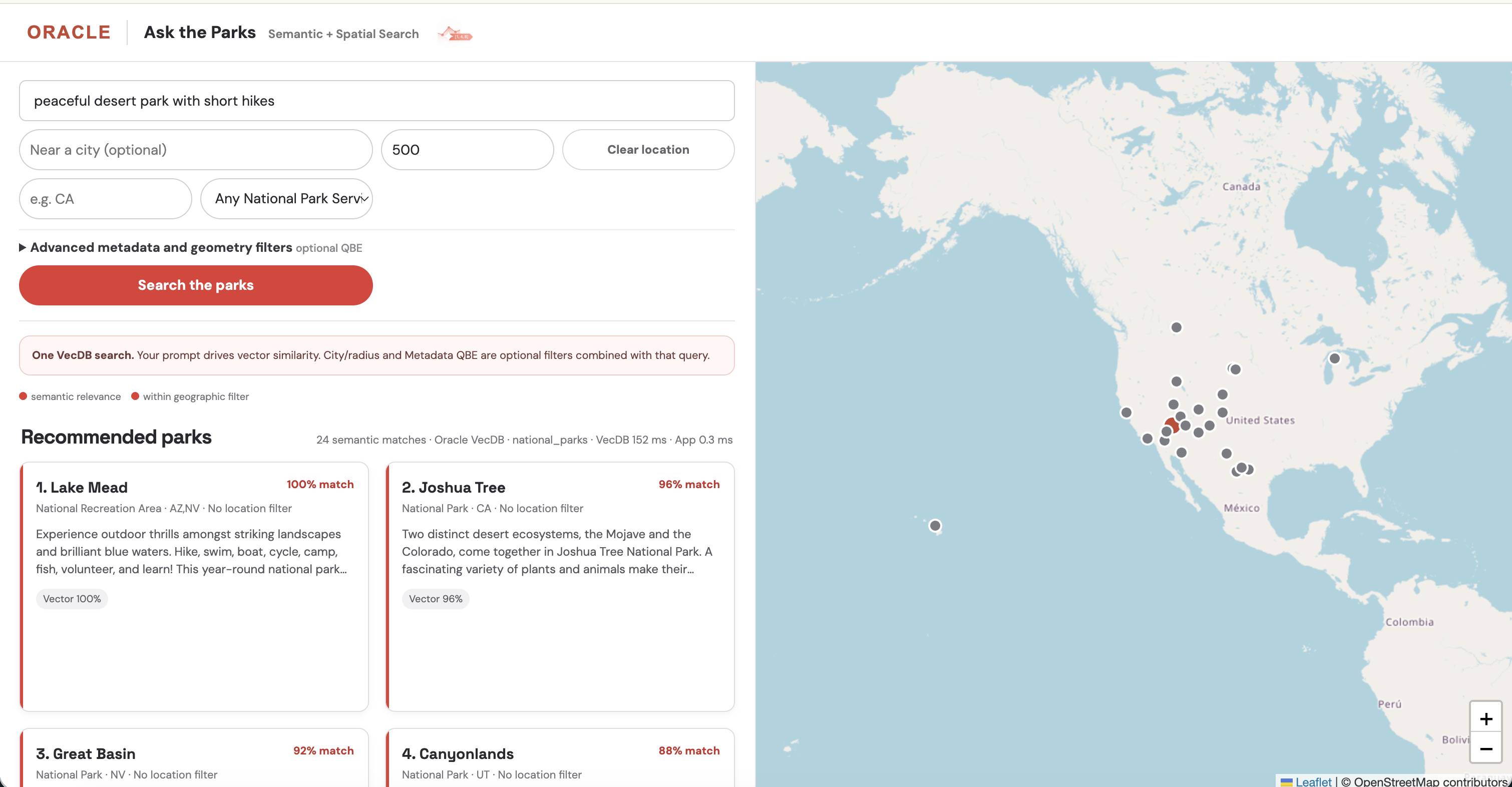
Semantic map search links ranked park cards, map markers, and the full park-details drawer.
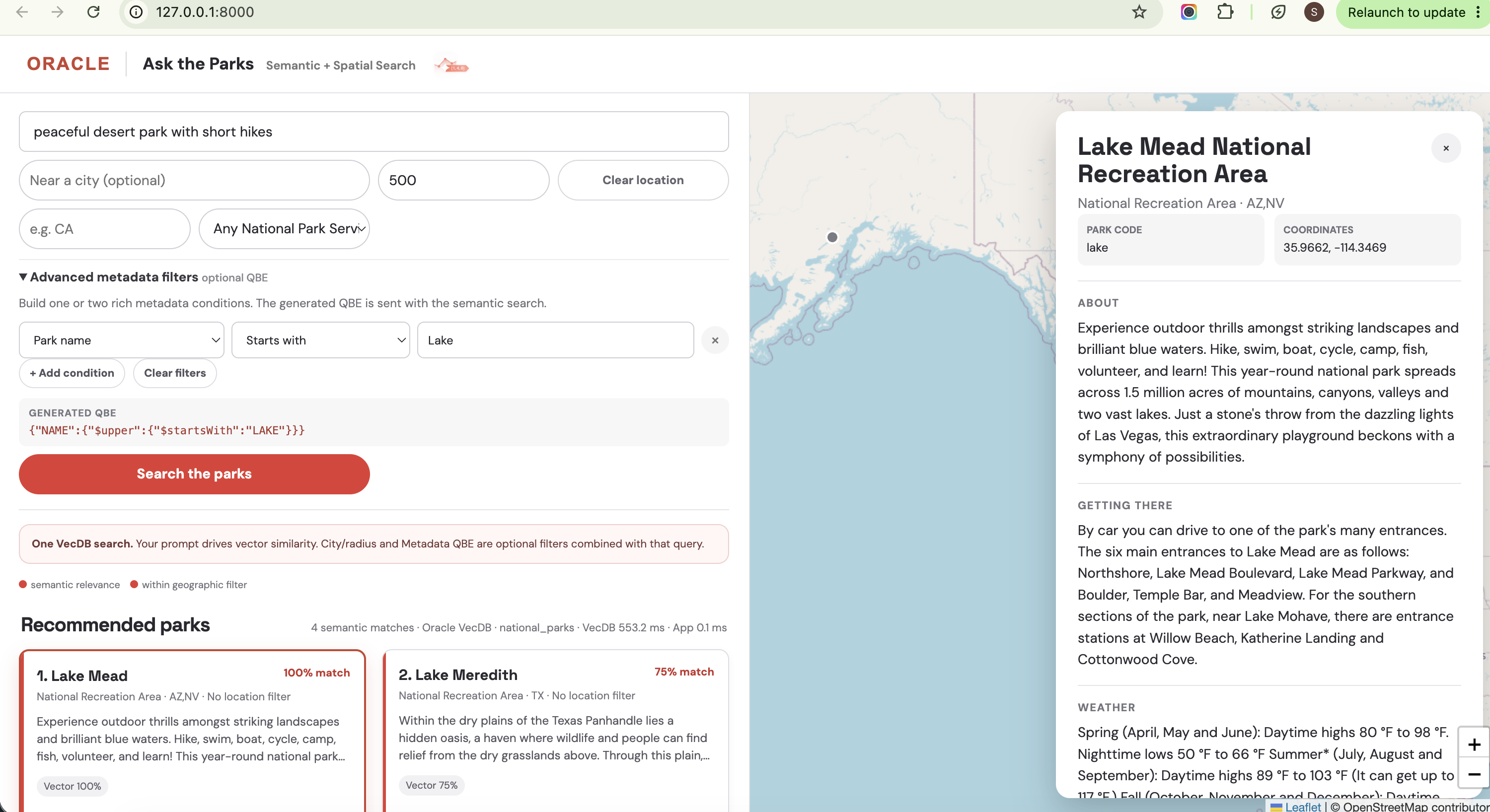
The advanced filter panel shows the generated QBE alongside the filtered map and park results.
What the app does
Ask the Parks is a map-and-list explorer for demonstrating Oracle VecDB with a real spatial dataset. A natural-language prompt, such as waterfall hikes or peaceful desert park with short hikes, is always sent as a semantic VecDB query. Location is optional: entering a city applies a GeoJSON $near radius filter; clearing the location returns to a nationwide semantic search. The Advanced metadata panel builds QBE filters for rich CSV fields without asking users to write JSON.
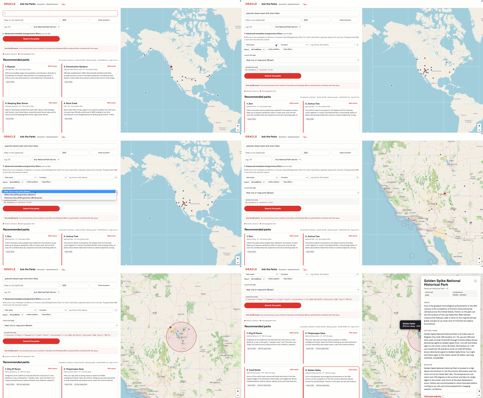 The interface is designed for a live demo:
- Results appear as linked cards and map markers; selecting either highlights the other.
- Clicking an empty map location searches again around that point. Clear location removes the spatial filter.
- Selecting a park opens its complete metadata record, fetched with
list_vectors(). - The result summary separates the VecDB
query()time from application-side processing time. - The metadata builder supports up to two conditions across park name/code, designation, state, description, directions, and weather. It supports contains, starts with, exact, and regex matching, and reveals the generated QBE for developers.
When VecDB is not configured, the app remains runnable using a local CSV/vector fallback. This is useful for UI development, but raw Metadata QBE is applied only when connected to Oracle VecDB.
Run the UI from the app directory:
cd apps/vecdb/vecdb_ask_parks
python3 app.py
Then open http://127.0.0.1:8000.
Connect Oracle VecDB
The app starts in a local CSV fallback mode. To use Oracle VecDB, copy .env.example to .env and configure these variables (or export them before starting it):
export VECDB_REST_URL="https://<host>:<port>/ords/<schema>/_/db-api/stable/vecdb/"
export VECDB_ACCESS_TOKEN="<bearer-token>"
export VECDB_TABLE="national_parks"
python3 app.py
Alternatively, set VECDB_USERNAME and VECDB_PASSWORD instead of VECDB_ACCESS_TOKEN. Bearer-token authentication takes precedence when both are set. TLS verification is enabled by default; set VECDB_SELF_SIGNED_SSL=true only for a development endpoint with an internal or otherwise untrusted certificate.
When configured, the app calls OracleVecDB.query() with a hosted text query and reports the VecDB call time separately from application-side response processing. A city/radius adds a QBE GeoJSON $near filter on metadata.location; leaving it blank, or using Clear location, runs semantic search across all parks. The Advanced metadata panel generates an optional JSON filter directly for VecDB. It covers PARK_CODE, NAME, DESIGNATION, STATES, DESCRIPTION, DIRECTIONS_INFO, and WEATHER_INFO; two completed conditions are combined with $and.
For example:
{ "PARK_CODE": "yose" }
The builder’s Contains option uses a generated $regex expression. Its Matches regex option accepts a regex pattern directly; for example, filtering Park name with .*Adams.* generates:
{ "NAME": { "$regex": ".*Adams.*" } }
The configured table must contain the park metadata, including location: {"type":"Point","coordinates":[longitude,latitude]}. If no VecDB variables are set, the supplied dense vectors are used for local cosine ranking and GeoJSON radius filtering; custom Metadata QBE requires an Oracle VecDB connection.
Create and load the parks table
load_parks_vecdb.py creates a text-queryable VecDB table and upserts the supplied dense vectors in batches. The QBE-ready CSV is included with this app, so use it as the default data source.
Before starting the UI for the first time, run this from the app directory to create and populate VECDB_TABLE from the bundled dataset:
cd apps/vecdb/vecdb_ask_parks
python3 load_parks_vecdb.py --csv-file data/us_national_parks_dataset_spatial.csv
Without this setup step, the UI can connect to VecDB but its search requests will fail because the configured table does not exist.
export VECDB_REST_URL="https://<host>:<port>/ords/<schema>/_/db-api/stable/vecdb/"
export VECDB_ACCESS_TOKEN="<bearer-token>"
export VECDB_TABLE="national_parks"
export VECDB_EMBED_MODEL="all_MiniLM_L12_v2"
python3 load_parks_vecdb.py --csv-file data/us_national_parks_dataset_spatial.csv
The embedding model must already be available in your VecDB service and must match the model used to produce the CSV vectors. The provided data contains 384-dimension vectors; all_MiniLM_L12_v2 is the default assumption and can be overridden with VECDB_EMBED_MODEL or --embed-model.
The script does not drop an existing table by default. To deliberately replace it, run:
python3 load_parks_vecdb.py --recreate
To load a dataset from a URL instead, set PARKS_CSV_URL in .env or pass --csv-url. Use --skip-create only after a failed run that already created the table.
GeoJSON location QBE in the UI
Open Advanced metadata and geometry filters in the UI. Near city or map point uses $near with the city/map coordinates and radius. Select Within GeoJSON geometry or Intersects GeoJSON geometry to paste a GeoJSON geometry; it is shown in Generated QBE and sent with the semantic query.
The metadata controls also support $in, $nin, $ne, and $exists; choose Match all conditions or Match any condition to generate $and or $or. Separate values with commas for Is one of and Is not one of.
For example, use this small San Francisco Bay Area polygon to verify either $within or $intersects:
{
  "type": "Polygon",
  "coordinates": [
    [
      [-123.2, 37.2],
      [-121.7, 37.2],
      [-121.7, 38.3],
      [-123.2, 38.3],
      [-123.2, 37.2]
    ]
  ]
}
Developer notebook
ask_the_parks_vecdb.ipynb is an executable walkthrough of the client configuration, table inspection, timed semantic query(), optional spatial GeoJSON QBE, combined metadata/spatial filters, and list_vectors() for the details drawer. Its create-and-load cell is disabled by default.